
These Odisha Districts May Witness Rain, Thunderstorm Today
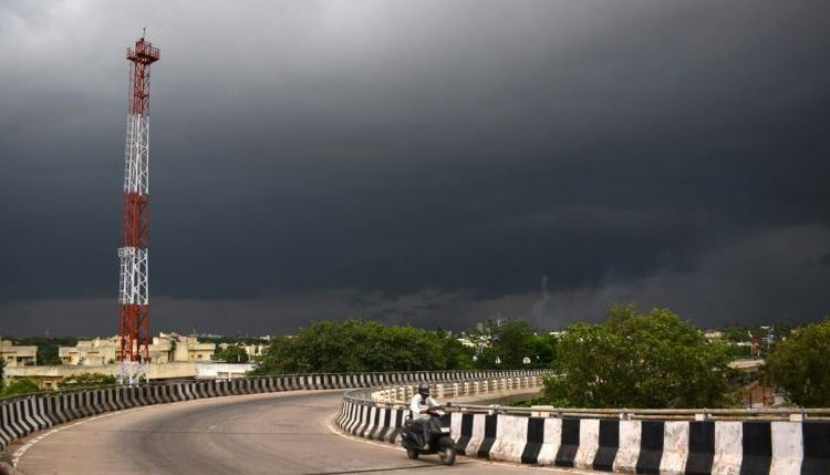
Bhubaneswar: Several districts in Odisha may witness rain or thunderstorm on June 5 (Monday), predicted the IMD today.
According to the IMD, light to moderate rain or thunderstorm is very likely to occur at a few places in Balasore, Bhadrak, Jajpur, Kendrapara, Mayurbhanj, Keonjhar, Ganjam, Gajapati, Rayagada, Koraput, Malkangiri and Kandhamal districts and at one or two places in the remaining districts of Odisha today.
Thunderstorms with lightning and gusty surface wind speed reaching 30-40 kmph are also likely at one or two places in Gajapati, Ganjam, Rayagada, Koraput, and Kandhamal. A yellow warning has been issued in this regard.
Thunderstorms with lightning are also likely to occur at one or two places in Balasore, Bhadrak, Jajpur, Kendrapara, Cuttack, Jagatsinghpur, Puri, Khurda, Nayagarh, Malkangiri, Mayurbhanj, Keonjhar, Sundargarh, Angul and Dhenkanal districts on Monday.
“The capital city of Bhubaneswar may witness one or two spells of rain or thundershower on June 5,” said the IMD weather bulletin.
At the same time, IMD said that winds over the south Arabian Sea continue to prevail up to 2.1 km above sea level. However, in view of a cyclonic circulation formed over the southeast Arabian Sea, the cloud mass is now more organised and concentrated over the same area and there has been some reduction of clouds off Kerala coasts in the last 24 hours.
Also, under the influence of this CYCIR, a low-pressure area is very likely to form over the same region during the next 24 hours. It is likely to move nearly northwards and intensify into a depression over the southeast and adjoining east-central Arabian Sea during the subsequent 48 hours. In view formation and intensification of this system and its near northward movement likely to influence the critical advance of the southwest monsoon towards the Kerala coast, so IMD is monitoring all these features and will issue daily updates of both the monsoon and the new system.