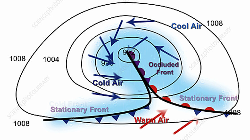
Animation of the development of a mid-latitude low pressure weather system, seen from above with north at top. Such systems form where warm air from the equator meets cool air from the poles, at a stationary front. Formation is typically driven by upper atmosphere air flows pulling air upwards. In the northern hemisphere, the Coriolis effect causes poleward-moving warm air (red arrows) to move eastwards, and polar air (blue) to move west. This leads to the front boundary developing a bend, and the start of a circular pattern of movement. Cold air is denser than warm air, and the cold front (blue triangles) undercuts warm air more quickly than warm front (red semicircles) can move into cold air, meaning the warm air is pushed upwards, lowering the air pressure beneath it. This aids the formation of a band of rain (blue regions) and high winds (arrows). Black isobars show the air pressure at 4 millibar intervals, with a low pressure region at the centre of the developing system. Eventually the fast-moving cold front catches up the slower warm front, undercutting it and lifting it, causing more rain and the formation of an occluded front (purple triangles and semicircles). With the warm air cut off from the system's centre the pressure rises as the air cools and sinks, leading to the dissipation of the occluded front and its associated rain, and the reforming of the stationary front boundary. These systems move eastwards over the surface of the Earth, and the passage of warm, cold and occluded fronts is responsible for the changeable weather in western Europe.
Bhubaneswar, Apr 3: On April 7, a low pressure area is very likely to form over southeast Bay of Bengal. According to the MeT Dept., on April 6, an upper air cyclonic circulation is likely to form over South Andaman Sea & neighbourhood.
“Under its influence, a Low Pressure Area is likely to form over Southeast Bay of Bengal during subsequent 24 hours (April 7),” the IMD stated.
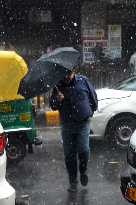
Meanwhile, several parts of the State reel under intense heatwave. On Sunday, 6 places in Odisha recorded maximum daytime temperature above 40 degrees Celcius (till 12 noon).
Bolangir recorded the highest maximum temperature of 42.2 degrees followed by Titilagarh (41.7 degrees) and Jharsuguda (41.5 degrees). Three other towns of Western Odisha recorded above 40 degrees temperature; they are as follows: Sundergarh (40.5), Sonepur (40.2) and Boudh (40.0).